Maps of Chestnut Hill, Lancaster, PA
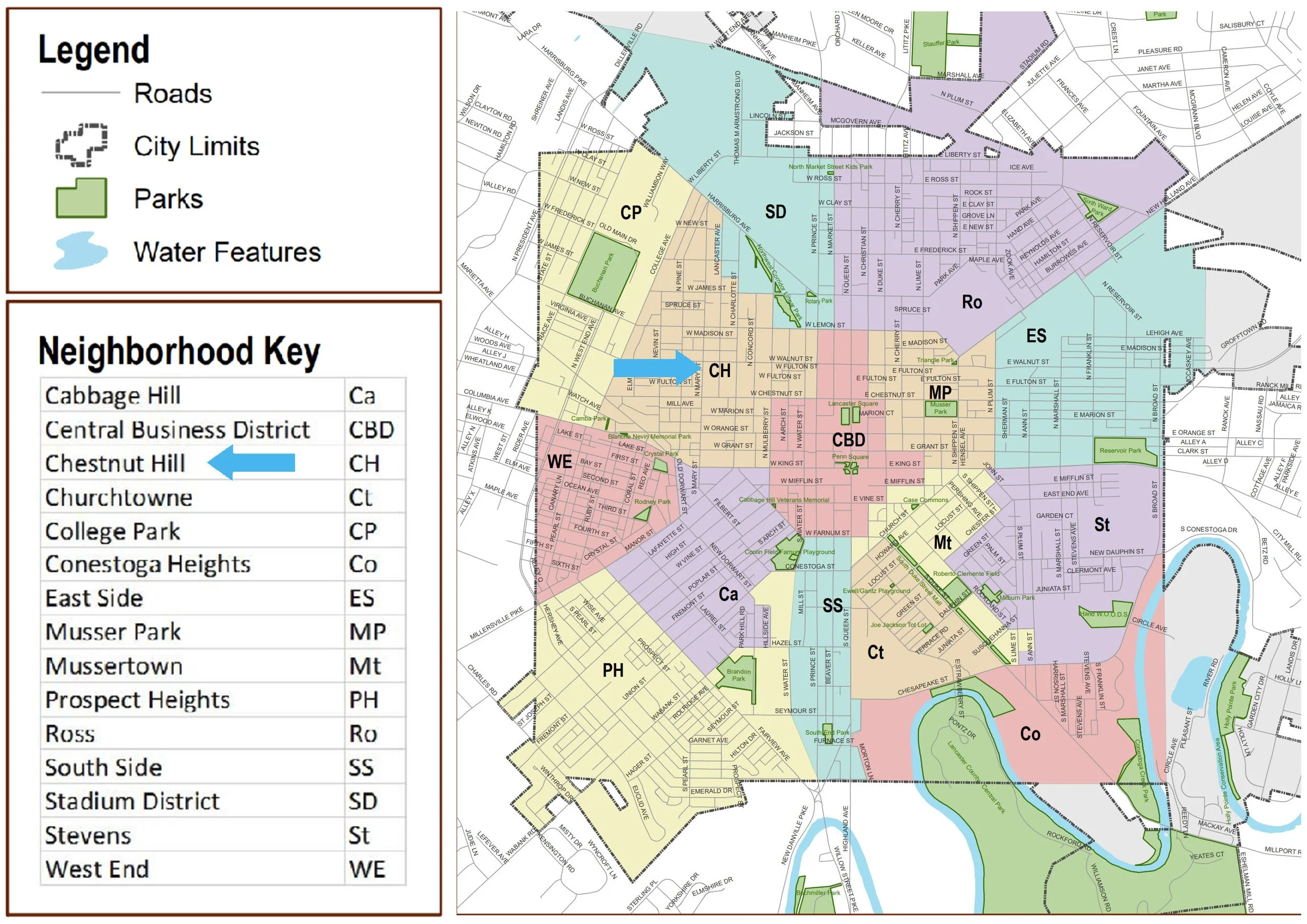
Above: Neighborhood map from the City of Lancaster’s website. (Arrows added.)
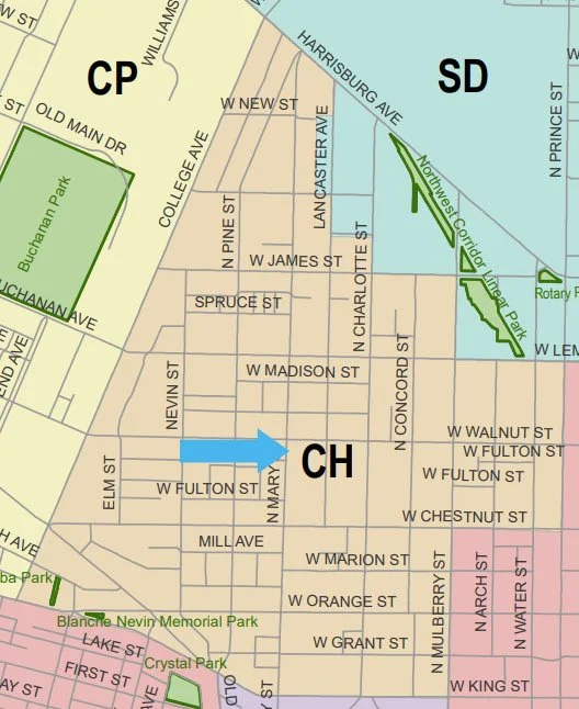
Above: CH: Chestnut Hill.
Is the Chestnut Hill neighborhood actually on a hill?
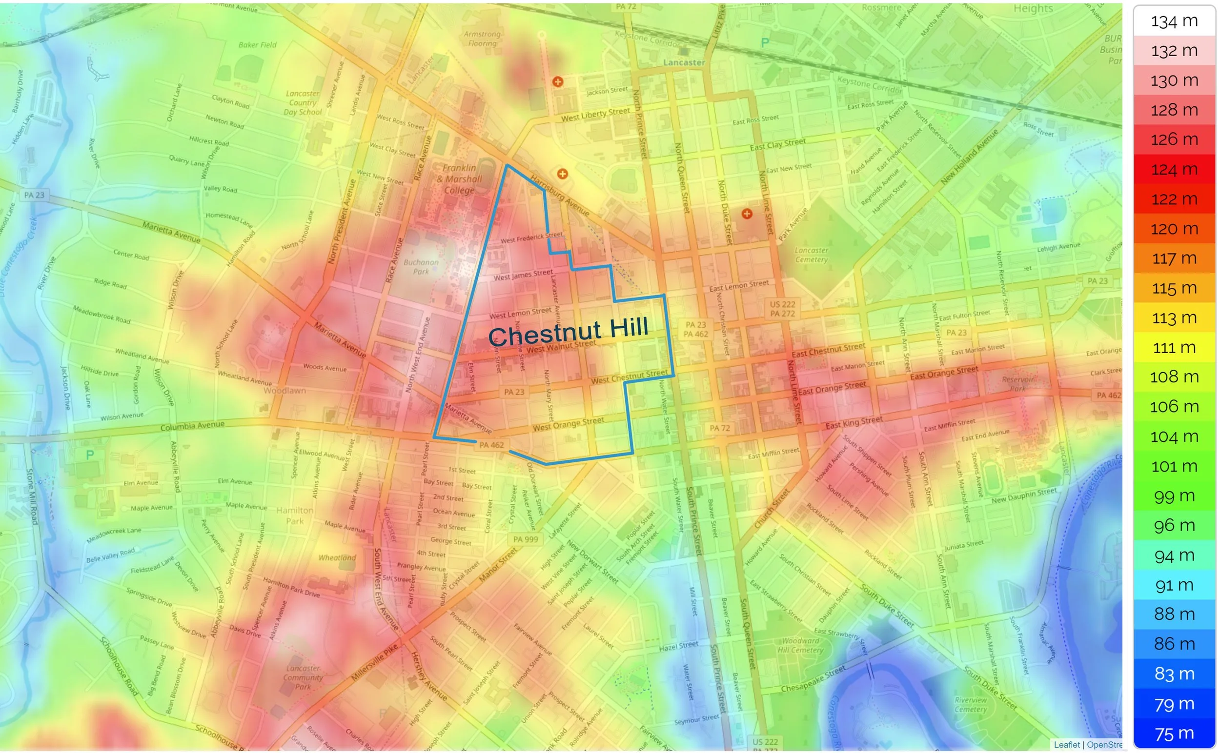
Map: topographic-map.com (with additions)
Above: This map reveals that the Chestnut Hill is higher in elevation than Lancaster’s central business district.
The city’s highest location is at F. and M. College’s Old Main building at 134 meters above sea level, according to this map. The city’s topography rises from a low elevation of 74 meters at the Conestoga River (map’s lower right corner).
Chestnut Hill Historic District and Conservation District:

Above: Chestnut Hill neighborhood (with additions). Complete map of city here.
Information about the historic district and conservation district here.
In Lancaster’s historic district exterior alterations to a building are subject to review by the Historical Architecture Review Board.
In 1999 City Council also created the Heritage Conservation District. All new construction and demolition projects in this conservation district that will have an impact on the surrounding streetscape must be reviewed and approved by the Historical Commission.
An 1850 map of Lancaster
Shows Chestnut Hill mostly undeveloped at that time:

1850 map of Lancaster: Library of Congress
Above: Detail of the 1850 map
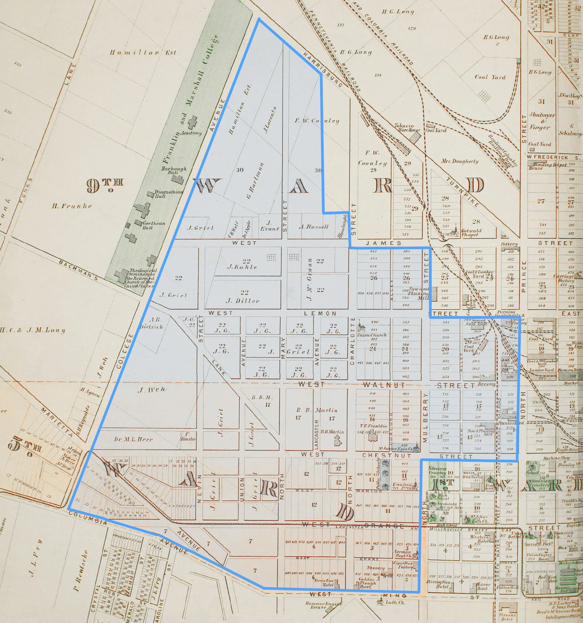
1864 Lancaster map shows Chestnut Hill being developed:

Above: 1864 Map: Bridgens’ Atlas of Lancaster Co., Penna. (blue color added at Chestnut Hill)
Above detail: 1864 Map: Bridgens’ Atlas of Lancaster Co., Penna. (Blue color added).
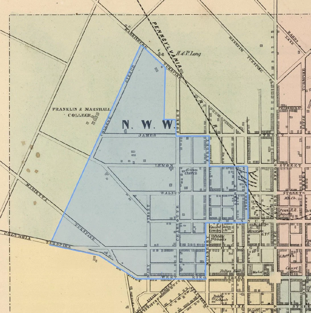
1875 Map of Lancaster shows further development to Chestnut Hill:
Above: 1875 Map: Combination Atlas Map of Lancaster County, Everts and Stewart. (Blue color added).
High resolution images of complete atlas is online at F. and M. College, here.
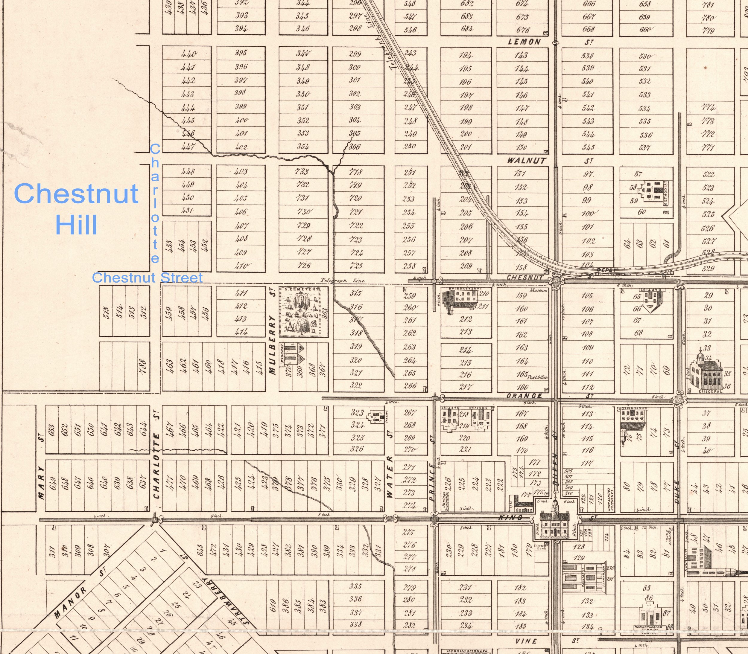
1899 map of Lancaster: More homes being built on Chestnut Hill:

Above: 1899 Map: Atlas of Surveys of the County of Lancaster, Graves and Steinbarger. (Blue color added).
High resolution images of complete atlas is online at F. and M. College, here.
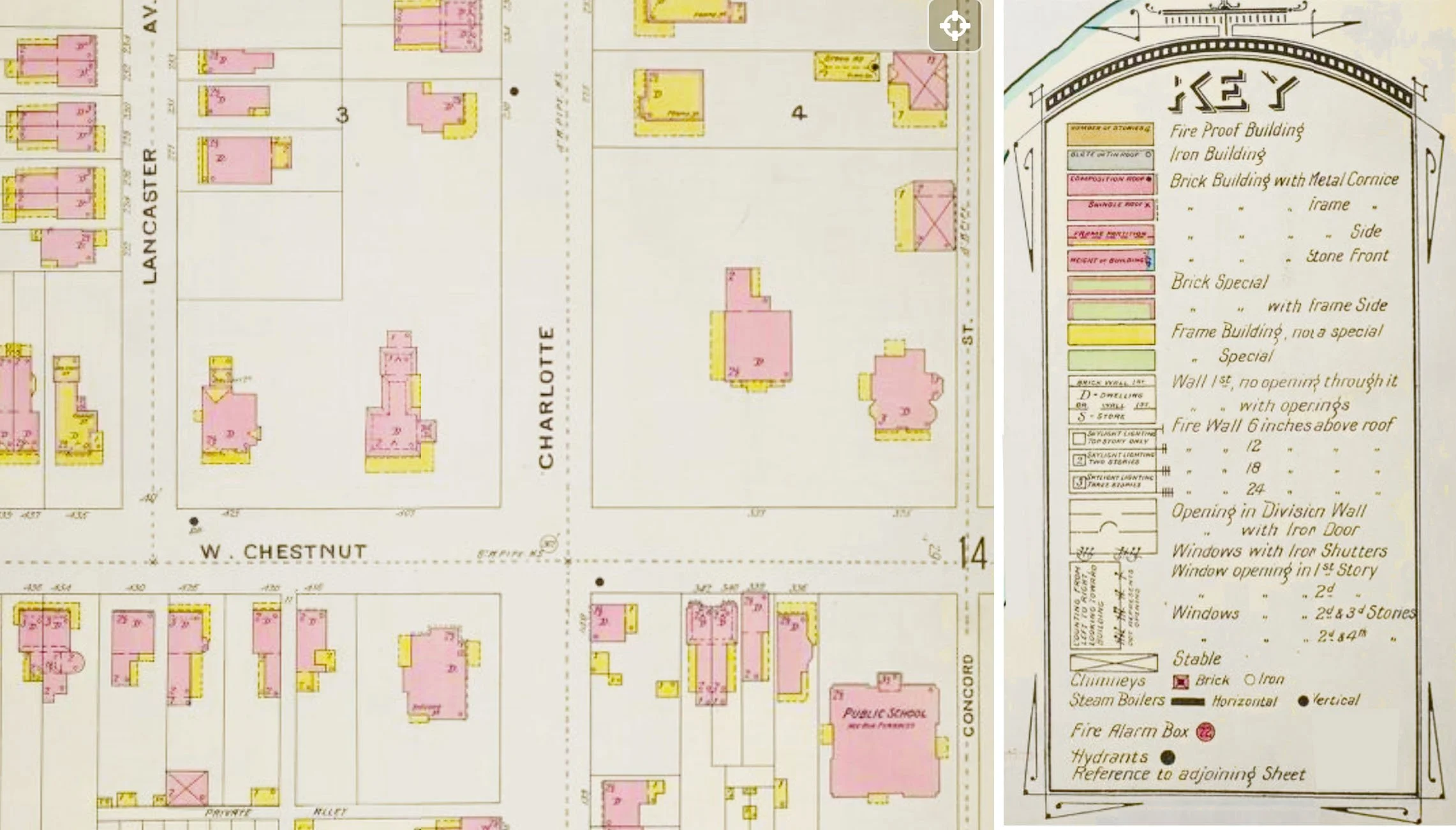
Three Sanborn Insurance Maps of Lancaster City: 1886, 1897, and 1912
Online at the Library of Congress: